UN
34 Fore Street
£ 225,000
Description
We don't have a Description for this property.
- Bedrooms
- 2
- Bathrooms
- 0
- Sqft
- 760.00
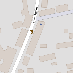

Leaflet © OpenStreetMap contributors
The heatmap indicates the level of crime in the area. The color of the heatmap indicates the crime severity and recency.
Metrics Year-on-Year
- Average area value
- 367,609.00 £Increased by 34.47 %
- Est sale value
- 310,840.00 £Unchanged by 0.00 %
- Average area rental value
- 1,048.00 £/moIncreased by 23.29 %
- Est letting value
- 760.00 £/moUnchanged by 0.00 %
- Est rental Yield
- 3.42 %Decreased by 8.31 %
- Crime Rate
- 98.00 %Unchanged by 0.00 %
from 273,386.00 £
from 310,840.00 £
from 850.00 £/mo
from 760.00 £/mo
from 3.73 %
from 98.00 %
Nearby Schools
| Name | Type | Ofsted | Distance |
|---|---|---|---|
| Silverton Church Of England Primary School | Voluntary Controlled School | Good | 0.58 KM |
| Bickleigh On Exe Church Of England Primary School | Academy Converter | Good | 4.81 KM |
| Thorverton Church Of England Primary School | Voluntary Controlled School | Good | 4.93 KM |
| Stoke Canon Church Of England Primary School And Pre-School | Voluntary Controlled School | Good | 5.63 KM |
| The Duchy School Bradninch | Academy Converter | Outstanding | 6.14 KM |
Images
Nearby Streets
| Name | Average Price | Average Sqft | Distance |
|---|---|---|---|
| Orchard Lane | £ 525,000 | 0 | 0.00 KM |
| Park Cottages | £ 0 | 0 | 0.00 KM |
| Drakes Meadow | £ 1,006,667 | 0 | 0.00 KM |
Nearby Transport
| Name | NLC | TLC | Distance |
|---|---|---|---|
| Pinhoe | 5757 | PIN | 9.00 KM |
| Polsloe Bridge | 3422 | POL | 9.81 KM |
Nearby Listings
| Address | Price | Type | Score | Distance |
|---|---|---|---|---|
| Fore Street, Silverton, Exeter, Devon, EX5 | £ 549,000 | BUY | Unknown | 0.06 KM |
| High Street, Silverton | £ 240,000 | BUY | 6 / 10 | 0.11 KM |
| King Street, Silverton, Exeter, Devon, EX5 | £ 250,000 | BUY | 7 / 10 | 0.11 KM |
| King street, Silverton | £ 250,000 | BUY | 5 / 10 | 0.12 KM |
| Orchard Lane, Silverton, Exeter | £ 525,000 | BUY | 6 / 10 | 0.14 KM |
Nearby Properties
| Address | Price | Distance |
|---|---|---|
| 31 Fore Street | £ 295,000 | 0.00 KM |
| 30a Fore Street | £ 294,000 | 0.00 KM |
| 36 Fore Street | £ 205,000 | 0.00 KM |
| 21 Fore Street | £ 431,000 | 0.00 KM |
| 32 Fore Street | £ 160,000 | 0.00 KM |